Trimble and Infotech to Streamline Inspection Measurement Workflows for Civil Infrastructure Projects
- Infotech’s Mobile Application Leverages Trimble Access Field Software for Accurate Measurement Capabilities for Survey-Grade Inspection Workflows
Trimble announced that Infotech, a leader in infrastructure construction software solutions, is adding high-accuracy positioning and measurement capabilities to its Mobile Inspector Measure Service application through an integration with Trimble Access field software. Infotech provides field staff with simple, yet powerful and configurable, mobile apps to manage data collection and inspection activities for digital delivery of civil infrastructure including Federal and State Department of Transportation (DOT) projects.

“Working with Infotech to integrate digital delivery technology, we enable DOT customers to streamline the office-to-field workflow and collaborate in a common data environment to deliver inspection and construction projects on-time with real-world accuracy,” said Cyndee Hoagland, senior vice president, Trimble Transportation & Infrastructure. “Today’s announcement represents our commitment to providing industry leading solutions centered on digital project delivery and we are excited to support DOT projects in the effort to modernize our transportation infrastructure.”
Recommended AI News: Sumo Logic and AWS Collaborate to Transform Security for Multi-Cloud and Hybrid Threat Protection
“Trimble recognizes the importance of an efficient, transparent and repeatable workflow that focuses on industry-specific solutions,” said Stephanie Michaud, strategic marketing manager, Trimble Surveying & Mapping Field Solutions. “By sharing precise geospatial measurements between Trimble Access and Infotech’s Mobile Inspector application, users can pair high-accuracy locations with asset inspection data to verify final as-built models for civil infrastructure projects.”

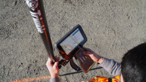
The Trimble and Infotech integration provides inspectors with a solution to use directly in the field. It allows users to easily capture the supporting geospatial data for measurements and eliminates data entry errors, which increases field productivity and project delivery.
Recommended AI News: Oracle Delivers Choice of Deployment for its Next-Generation Cloud
“Field data collection is historically manual and prone to errors due to inefficient, manual processes. Through this integration, we are helping field staff quickly collect accurate, auditable data and connecting it to the estimate process with a single point of data entry,” said Chad Schafer, associate vice president of Business Development and Sales at Infotech. “Trimble is a tremendous player in the industry with proven surveying technology, and we are excited to integrate two of our software applications to create a more tech-empowered field workforce.”
Recommended AI News: Actian Avalanche Pioneers Next-Generation Cloud Data Warehouse

Comments are closed.